Geolokalisieren

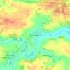
Topografische Karte Wramplingham

Klicken Sie auf die Karte, um die Höhe anzuzeigen.

Über diese Karte

Name: Topografische Karte Wramplingham, Höhe, Relief.

Ort: Wramplingham, South Norfolk, Norfolk, England, United Kingdom (52.59902 1.10337 52.62525 1.13547)

Durchschnittliche Höhe: 33 m

Minimale Höhe: 14 m

Maximale Höhe: 50 m

Andere topografische Karten

Klicken Sie auf eine Karte, um ihre Topografie, ihre Höhe und ihr Relief anzuzeigen.

Hapton

United Kingdom > England > Norfolk > South Norfolk

Durchschnittliche Höhe: 37 m

Welborne

United Kingdom > England > Norfolk > South Norfolk

Durchschnittliche Höhe: 48 m

Harleston

United Kingdom > England > Norfolk > South Norfolk

Durchschnittliche Höhe: 37 m

Trowse

United Kingdom > England > Norfolk > South Norfolk

Durchschnittliche Höhe: 23 m

Marlingford

United Kingdom > England > Norfolk > South Norfolk

Durchschnittliche Höhe: 34 m

Chapel Hill

United Kingdom > England > Norfolk > South Norfolk

Durchschnittliche Höhe: 18 m

Beckhithe

United Kingdom > England > Norfolk > South Norfolk > Little Melton > Beckhithe

Durchschnittliche Höhe: 37 m

Tivetshall St Margaret

United Kingdom > England > Norfolk > South Norfolk

Durchschnittliche Höhe: 49 m

Fersfield

United Kingdom > England > Norfolk > South Norfolk > Fersfield

Durchschnittliche Höhe: 45 m

Tivetshall St Mary

United Kingdom > England > Norfolk > South Norfolk

Durchschnittliche Höhe: 46 m

Burston

United Kingdom > England > Norfolk > South Norfolk

Durchschnittliche Höhe: 40 m

Deopham Green

United Kingdom > England > Norfolk > South Norfolk > Deopham

Durchschnittliche Höhe: 51 m

Morningthorpe

United Kingdom > England > Norfolk > South Norfolk

Durchschnittliche Höhe: 46 m

Morley St Peter

United Kingdom > England > Norfolk > South Norfolk

Durchschnittliche Höhe: 48 m

Thorpe Abbotts

United Kingdom > England > Norfolk > South Norfolk

Durchschnittliche Höhe: 40 m

Kirby Row

United Kingdom > England > Norfolk > South Norfolk > Kirby Cane

Durchschnittliche Höhe: 16 m
Thurlton Links

United Kingdom > England > Norfolk > South Norfolk > Thurlton

Durchschnittliche Höhe: 14 m

Hethel

United Kingdom > England > Norfolk > South Norfolk

Durchschnittliche Höhe: 47 m

Sneath Common

United Kingdom > England > Norfolk > South Norfolk

Durchschnittliche Höhe: 51 m

Keswick

United Kingdom > England > Norfolk > South Norfolk

Durchschnittliche Höhe: 23 m

Tharston

United Kingdom > England > Norfolk > South Norfolk

Durchschnittliche Höhe: 37 m

Highoak

United Kingdom > England > Norfolk > South Norfolk > Morley St Botolph

Durchschnittliche Höhe: 47 m
Caistor St Edmund

United Kingdom > England > Norfolk > South Norfolk

Durchschnittliche Höhe: 28 m

Forncett End

United Kingdom > England > Norfolk > South Norfolk > Tacolneston

Durchschnittliche Höhe: 53 m

Lushbush

United Kingdom > England > Norfolk > South Norfolk > Harleston

Durchschnittliche Höhe: 33 m

Thorpe Abbotts

United Kingdom > England > Norfolk > South Norfolk

Durchschnittliche Höhe: 40 m

Harleston

United Kingdom > England > Norfolk > South Norfolk

Durchschnittliche Höhe: 37 m

Surlingham

United Kingdom > England > Norfolk > South Norfolk

Durchschnittliche Höhe: 12 m

Rüste dich für dein nächstes Abenteuer:

🗺️Topographische Wanderkarten - Detaillierte Karten für die sichere Planung und Orientierung
🍳Outdoor Kochset - Leichtes Geschirr aus Aluminium oder Titan
🧺Spezialwaschmittel Outdoor - Reinigt Membranen wie GORE-TEX schonend
🧤Outdoor Handschuhe - Schutz vor Kälte und Wind
🔭Kompaktes Fernrohr - Ideal zur Geländesichtung und Pfadfindung aus der Ferne

Als Amazon-Partner verdient diese Website an qualifizierten Käufen, ohne zusätzliche Kosten für Sie.