
Topografische Karte Mount Willard
Interaktive Karte
Klicken Sie auf die Karte, um die Höhe anzuzeigen.
Über diese Karte
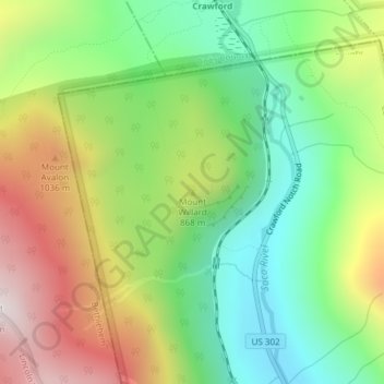
Name: Topografische Karte Mount Willard, Höhe, Relief.
Durchschnittliche Höhe: 775 m
Minimale Höhe: 417 m
Maximale Höhe: 1.297 m
Andere topografische Karten
Klicken Sie auf eine Karte, um ihre Topografie, ihre Höhe und ihr Relief anzuzeigen.
Sawyers River
United States > New Hampshire > Carroll County > Hart's Location
Sawyers River, Hart's Location, Carroll County, New Hampshire, United States
Durchschnittliche Höhe: 457 m
Crawford Notch State Park
United States > New Hampshire > Carroll County > Hart's Location
Crawford Notch State Park, Hart's Location, Carroll County, New Hampshire, United States
Durchschnittliche Höhe: 796 m