
Topografische Karte Sebastopol
Interaktive Karte
Klicken Sie auf die Karte, um die Höhe anzuzeigen.
Über diese Karte
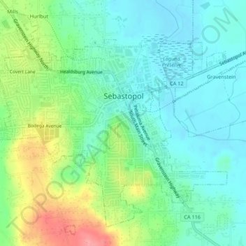
Name: Topografische Karte Sebastopol, Höhe, Relief.
Ort: Sebastopol, Sonoma County, California, United States (38.38386 -122.84816 38.41307 -122.80680)
Durchschnittliche Höhe: 43 m
Minimale Höhe: 15 m
Maximale Höhe: 108 m
Sebastopol's elevation is 65 to 250 feet (20 to 76 meters) above sea level. Its downtown is at the intersection of State Route 12 and State Route 116 (Gravenstein Highway), approximately 9 mi (14 km) west of U.S. Route 101.