
Topografische Karte Thompson Falls
Interaktive Karte
Klicken Sie auf die Karte, um die Höhe anzuzeigen.
Über diese Karte
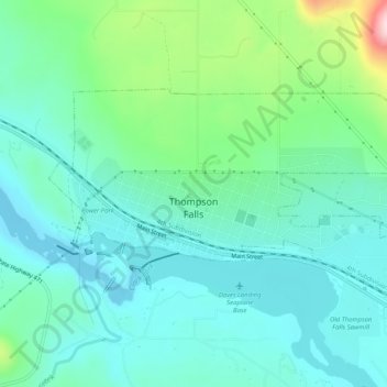
Name: Topografische Karte Thompson Falls, Höhe, Relief.
Durchschnittliche Höhe: 782 m
Minimale Höhe: 713 m
Maximale Höhe: 1.022 m
Thompson Falls is located in the Clark Fork Valley at an elevation of 2,419 feet (737 m). The Clark Fork River flows on the southern side of town. It is next to the Cabinet Mountains.