
Topografische Karte White River
Interaktive Karte
Klicken Sie auf die Karte, um die Höhe anzuzeigen.
Über diese Karte
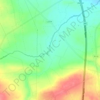
Name: Topografische Karte White River, Höhe, Relief.
Durchschnittliche Höhe: 75 m
Minimale Höhe: 44 m
Maximale Höhe: 119 m
Andere topografische Karten
Klicken Sie auf eine Karte, um ihre Topografie, ihre Höhe und ihr Relief anzuzeigen.
Termonfeckin
Termonfeckin, Termonfeckin ED, The Borough District of Drogheda, County Louth, Leinster, Ireland
Durchschnittliche Höhe: 16 m
The Borough District of Drogheda
The Borough District of Drogheda, County Louth, Leinster, Ireland
Durchschnittliche Höhe: 50 m
Collon
Collon, Collon ED, The Municipal District of Ardee, County Louth, Leinster, Ireland
Durchschnittliche Höhe: 142 m
Drumlin ( E.D. Dunleer)
Drumlin ( E.D. Dunleer), Dunleer ED, The Municipal District of Ardee, County Louth, Leinster, Ireland
Durchschnittliche Höhe: 49 m
Greatwood
Greatwood, Clonkeen ED, The Municipal District of Ardee, County Louth, Leinster, Ireland
Durchschnittliche Höhe: 40 m
Dundalk
Ireland > County Louth > Dundalk
Dundalk, The Municipal District of Dundalk, County Louth, Leinster, A91 RC44, Ireland
Durchschnittliche Höhe: 16 m