
Topografische Karte Whidbey Island
Interaktive Karte
Klicken Sie auf die Karte, um die Höhe anzuzeigen.
Über diese Karte
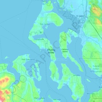
Name: Topografische Karte Whidbey Island, Höhe, Relief.
Ort: Whidbey Island, Island County, Washington, United States (47.90492 -122.76999 48.41132 -122.34936)
Durchschnittliche Höhe: 45 m
Minimale Höhe: -4 m
Maximale Höhe: 993 m
Whidbey Island lies partially in the rain shadow of the Olympic Mountain Range to the west, and has a variety of climate zones. This can be observed by rainfall amounts – wettest in the south with average rainfall of 36 inches (910 mm), driest in the central district of Coupeville with average rainfall of 20 to 22 inches (510 to 560 mm), and turning moister again farther north with average rainfall of 32 inches (810 mm). Microclimates abound, determined by proximity to water, elevation and prevailing winds.