
Topografische Karte Bedford County
Interaktive Karte
Klicken Sie auf die Karte, um die Höhe anzuzeigen.
Über diese Karte
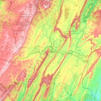
Name: Topografische Karte Bedford County, Höhe, Relief.
Ort: Bedford County, Pennsylvania, United States of America (39.72246 -78.80828 40.32703 -78.13472)
Durchschnittliche Höhe: 491 m
Minimale Höhe: 133 m
Maximale Höhe: 956 m
Andere topografische Karten
Klicken Sie auf eine Karte, um ihre Topografie, ihre Höhe und ihr Relief anzuzeigen.
Dalmatia
United States of America > Pennsylvania > Dalmatia
Dalmatia, Northumberland County, Pennsylvania, 17017, United States of America
Durchschnittliche Höhe: 172 m
Montgomery County
United States of America > Pennsylvania
Montgomery County, Pennsylvania, United States of America
Durchschnittliche Höhe: 109 m