
Topografische Karte Modła
Interaktive Karte
Klicken Sie auf die Karte, um die Höhe anzuzeigen.
Über diese Karte
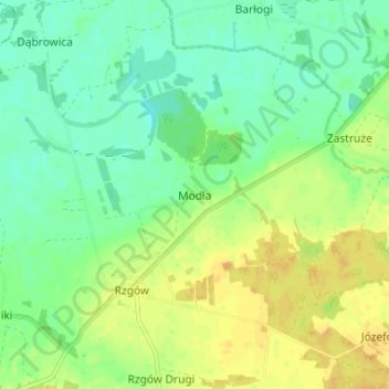
Name: Topografische Karte Modła, Höhe, Relief.
Durchschnittliche Höhe: 85 m
Minimale Höhe: 73 m
Maximale Höhe: 100 m
Andere topografische Karten
Klicken Sie auf eine Karte, um ihre Topografie, ihre Höhe und ihr Relief anzuzeigen.
Boguszyce
Poland > Greater Poland Voivodeship > Konin County
Boguszyce, gmina Wierzbinek, Konin County, Greater Poland Voivodeship, 62-618, Poland
Durchschnittliche Höhe: 98 m
Synogać
Poland > Greater Poland Voivodeship > Konin County
Synogać, gmina Wierzbinek, Konin County, Greater Poland Voivodeship, 62-618, Poland
Durchschnittliche Höhe: 96 m