
Topografische Karte Cold Spring
Interaktive Karte
Klicken Sie auf die Karte, um die Höhe anzuzeigen.
Über diese Karte
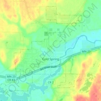
Name: Topografische Karte Cold Spring, Höhe, Relief.
Durchschnittliche Höhe: 349 m
Minimale Höhe: 327 m
Maximale Höhe: 383 m
Andere topografische Karten
Klicken Sie auf eine Karte, um ihre Topografie, ihre Höhe und ihr Relief anzuzeigen.
St. Joseph
États-Unis d'Amérique > Minnesota > Stearns County
St. Joseph, Stearns County, Minnesota, États-Unis d'Amérique
Durchschnittliche Höhe: 336 m
St. Cloud
États-Unis d'Amérique > Minnesota > Stearns County
St. Cloud, Stearns County, Minnesota, États-Unis d'Amérique
Durchschnittliche Höhe: 319 m