
Topografische Karte Cherrapunji (Sohra)
Interaktive Karte
Klicken Sie auf die Karte, um die Höhe anzuzeigen.
Über diese Karte
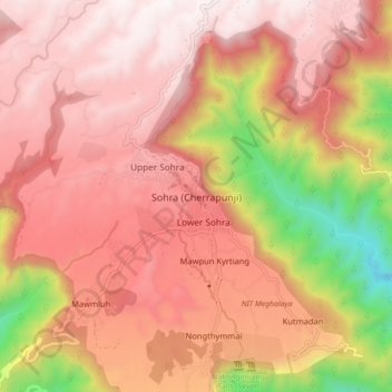
Name: Topografische Karte Cherrapunji (Sohra), Höhe, Relief.
Durchschnittliche Höhe: 1.248 m
Minimale Höhe: 332 m
Maximale Höhe: 1.677 m
It has an average elevation of 1,430 metres (4,690 ft) and sits on a plateau in the southern part of the Khasi Hills, facing the plains of Bangladesh. The plateau rises 660 meters above the surrounding valleys.