
Topografische Karte Badplaas
Interaktive Karte
Klicken Sie auf die Karte, um die Höhe anzuzeigen.
Über diese Karte
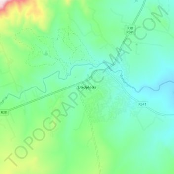
Name: Topografische Karte Badplaas, Höhe, Relief.
Durchschnittliche Höhe: 1.152 m
Minimale Höhe: 981 m
Maximale Höhe: 1.699 m
Andere topografische Karten
Klicken Sie auf eine Karte, um ihre Topografie, ihre Höhe und ihr Relief anzuzeigen.
eLukwatini
South Africa > Mpumalanga > Gert Sibande District Municipality > Albert Luthuli Local Municipality
eLukwatini, Albert Luthuli Local Municipality, Gert Sibande District Municipality, Mpumalanga, 1192, South Africa
Durchschnittliche Höhe: 1.033 m