
Topografische Karte Florida Keys
Interaktive Karte
Klicken Sie auf die Karte, um die Höhe anzuzeigen.
Florida Keys
Tropical cyclones present special dangers and challenges to the entire Keys. Because no area of the islands is more than 20 feet (6.1 m) above sea level (and many are only a few feet elevation), and water surrounds the islands, nearly every neighborhood is subject to flooding as well as hurricane winds. In response, many homes in the Keys are built on concrete stilts with the first floor being not legally habitable and enclosed by breakaway walls that are not strongly attached to the rest of the house. Nonetheless, Monroe County, as reported in the Federal Register, has estimated that there are between 8,000 and 12,000 illegal enclosures inhabited by people.
Über diese Karte
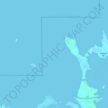
Name: Topografische Karte Florida Keys, Höhe, Relief.
Ort: Florida Keys, Monroe County, Florida, United States (24.66704 -81.58319 24.66714 -81.58309)
Durchschnittliche Höhe: 0 m
Minimale Höhe: -2 m
Maximale Höhe: 5 m
Andere topografische Karten
Klicken Sie auf eine Karte, um ihre Topografie, ihre Höhe und ihr Relief anzuzeigen.
Key West
United States > Florida > Monroe County
Key West is an island located at 24°33′55″N 81°46′33″W / 24.565176°N 81.775794°W / 24.565176; -81.775794 in the Straits of Florida. The island is about 4 miles (6 km) long and 1 mile (2 km) wide, with a total land area of 4.2 square miles (10.9 km2; 2,688.0 acres). The average elevation…
Durchschnittliche Höhe: 1 m