
Topografische Karte Humel
Interaktive Karte
Klicken Sie auf die Karte, um die Höhe anzuzeigen.
Über diese Karte
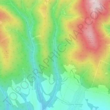
Name: Topografische Karte Humel, Höhe, Relief.
Durchschnittliche Höhe: 518 m
Minimale Höhe: 343 m
Maximale Höhe: 785 m
Andere topografische Karten
Klicken Sie auf eine Karte, um ihre Topografie, ihre Höhe und ihr Relief anzuzeigen.
Rudník
Slovakia > Region of Košice > District of Košice - okolie > Rudník
Rudník, District of Košice - okolie, Region of Košice, Eastern Slovakia, 044 23, Slovakia
Durchschnittliche Höhe: 337 m
Haniska
Slovakia > Region of Košice > District of Košice - okolie
Haniska, District of Košice - okolie, Region of Košice, Eastern Slovakia, Slovakia
Durchschnittliche Höhe: 206 m