
Topografische Karte San Rafael
Interaktive Karte
Klicken Sie auf die Karte, um die Höhe anzuzeigen.
Über diese Karte
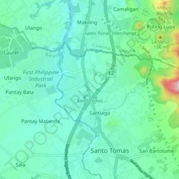
Name: Topografische Karte San Rafael, Höhe, Relief.
Durchschnittliche Höhe: 158 m
Minimale Höhe: 89 m
Maximale Höhe: 460 m
Andere topografische Karten
Klicken Sie auf eine Karte, um ihre Topografie, ihre Höhe und ihr Relief anzuzeigen.
San Luis
Philippines > Batangas > Santo Tomas
San Luis, Santo Tomas, Batangas, Calabarzon, 4234, Philippines
Durchschnittliche Höhe: 293 m
Santo Tomas
Philippines > Batangas > Santo Tomas > Santo Tomas
Santo Tomas, Batangas, Calabarzon, 4234, Philippines
Durchschnittliche Höhe: 154 m