
Topografische Karte Brussels
Klicken Sie auf die Karte, um die Höhe anzuzeigen.
Über diese Karte
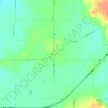
Name: Topografische Karte Brussels, Höhe, Relief.
Durchschnittliche Höhe: 227 m
Minimale Höhe: 212 m
Maximale Höhe: 259 m
Andere topografische Karten
Klicken Sie auf eine Karte, um ihre Topografie, ihre Höhe und ihr Relief anzuzeigen.
Whitefish Dunes State Park
United States > Wisconsin > Door County > Sturgeon Bay
Durchschnittliche Höhe: 181 m
Rock Island
United States > Wisconsin > Door County
Rock Island is a mostly wooded island off the tip of Wisconsin's Door Peninsula at the mouth of Green Bay, in Door County, Wisconsin. The 974.87-acre (394.5 ha) island is approximately 1.6 miles (2.6 km) long and 1.1 miles (1.8 km) wide. It rises to 65 meters above Lake Michigan, making it the highest in…
Durchschnittliche Höhe: 188 m
Bailey's Harbor Boreal Forest And Wetlands State Natural Area
United States > Wisconsin > Door County
Durchschnittliche Höhe: 181 m
Potawatomi State Park
United States > Wisconsin > Door County > Sturgeon Bay
Durchschnittliche Höhe: 195 m
Peninsula State Park
United States > Wisconsin > Door County > Fish Creek
Durchschnittliche Höhe: 194 m