Geolokalisieren

Topografische Karte Bara

Interaktive Karte

Klicken Sie auf die Karte, um die Höhe anzuzeigen.

Über diese Karte

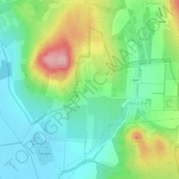
Name: Topografische Karte Bara, Höhe, Relief.

Ort: Bara, District of Trebišov, Region of Košice, Eastern Slovakia, Slovakia (48.40896 21.70662 48.43916 21.74904)

Durchschnittliche Höhe: 160 m

Minimale Höhe: 108 m

Maximale Höhe: 267 m

The village lies at an altitude of 181 metres and covers an area of 6.252 km². It has a population of 350 people.

Wikipedia (CC-BY-SA 3.0)

Andere topografische Karten

Klicken Sie auf eine Karte, um ihre Topografie, ihre Höhe und ihr Relief anzuzeigen.

Bačka

Slovakia > Region of Košice > District of Trebišov

Bačka, District of Trebišov, Region of Košice, Eastern Slovakia, Slovakia

Durchschnittliche Höhe: 101 m

Streda nad Bodrogom

Slovakia > Region of Košice > District of Trebišov

Streda nad Bodrogom, District of Trebišov, Region of Košice, Eastern Slovakia, 076 31, Slovakia

Durchschnittliche Höhe: 106 m

Boťany

Slovakia > Region of Košice > District of Trebišov

Boťany, District of Trebišov, Region of Košice, Eastern Slovakia, 076 43, Slovakia

Durchschnittliche Höhe: 101 m