
Topografische Karte Wayne
Klicken Sie auf die Karte, um die Höhe anzuzeigen.
Über diese Karte
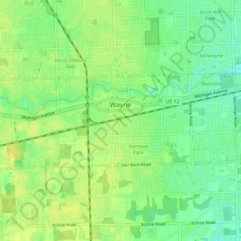
Name: Topografische Karte Wayne, Höhe, Relief.
Ort: Wayne, Wayne County, Michigan, 48184, United States (42.26571 -83.42742 42.28919 -83.34807)
Durchschnittliche Höhe: 201 m
Minimale Höhe: 191 m
Maximale Höhe: 210 m
Andere topografische Karten
Klicken Sie auf eine Karte, um ihre Topografie, ihre Höhe und ihr Relief anzuzeigen.
Detroit
United States > Michigan > Wayne County
The city slopes gently from the northwest to southeast on a till plain composed largely of glacial and lake clay. The most notable topographical feature in the city is the Detroit Moraine, a broad clay ridge on which the older portions of Detroit and Windsor are located, rising approximately 62 feet (19 m)…
Durchschnittliche Höhe: 186 m
New Boston
United States > Michigan > Wayne County > Huron Charter Township
Durchschnittliche Höhe: 196 m
Belleville North
United States > Michigan > Wayne County > Van Buren Charter Township
Durchschnittliche Höhe: 208 m
Edgewater Heights
United States > Michigan > Wayne County > Van Buren Charter Township
Durchschnittliche Höhe: 208 m