Topografische Karte Lac d'Enchanet
Interaktive Karte
Klicken Sie auf die Karte, um die Höhe anzuzeigen.
Über diese Karte
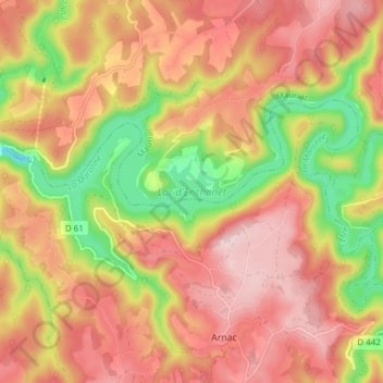
Name: Topografische Karte Lac d'Enchanet, Höhe, Relief.
Durchschnittliche Höhe: 537 m
Minimale Höhe: 378 m
Maximale Höhe: 650 m

Klicken Sie auf die Karte, um die Höhe anzuzeigen.
Name: Topografische Karte Lac d'Enchanet, Höhe, Relief.
Durchschnittliche Höhe: 537 m
Minimale Höhe: 378 m
Maximale Höhe: 650 m