
Topografische Karte Mont Gosford
Interaktive Karte
Klicken Sie auf die Karte, um die Höhe anzuzeigen.
Über diese Karte
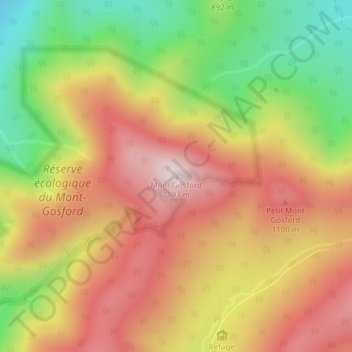
Name: Topografische Karte Mont Gosford, Höhe, Relief.
Durchschnittliche Höhe: 933 m
Minimale Höhe: 641 m
Maximale Höhe: 1.178 m
Since 1978, Mount Gosford is included in "ZEC Louise-Gosford", a controlled harvesting zone open to the public. Recently, the areas at more than 700 metres of altitude were designated Important Bird Areas due to the presence Bicknell's thrushes, an endemic species living in mountain peaks of northeast North America.