
Topografische Karte Tlapeng
Interaktive Karte
Klicken Sie auf die Karte, um die Höhe anzuzeigen.
Über diese Karte
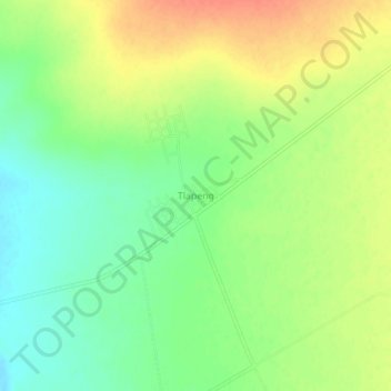
Name: Topografische Karte Tlapeng, Höhe, Relief.
Durchschnittliche Höhe: 1.266 m
Minimale Höhe: 1.244 m
Maximale Höhe: 1.289 m
Andere topografische Karten
Klicken Sie auf eine Karte, um ihre Topografie, ihre Höhe und ihr Relief anzuzeigen.
Rusten
South Africa > North West > Dr Ruth Segomotsi Mompati District Municipality > Kagisano-Molopo Local Municipality
Rusten, Kagisano-Molopo Local Municipality, Dr Ruth Segomotsi Mompati District Municipality, North West, South Africa
Durchschnittliche Höhe: 1.206 m