
Topografische Karte Kaalspruit
Interaktive Karte
Klicken Sie auf die Karte, um die Höhe anzuzeigen.
Über diese Karte
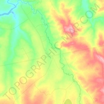
Name: Topografische Karte Kaalspruit, Höhe, Relief.
Durchschnittliche Höhe: 1.603 m
Minimale Höhe: 1.550 m
Maximale Höhe: 1.668 m
Andere topografische Karten
Klicken Sie auf eine Karte, um ihre Topografie, ihre Höhe und ihr Relief anzuzeigen.
Blesbokspruit
South Africa > Mpumalanga > Gert Sibande > Lekwa Local Municipality
Blesbokspruit, Lekwa Local Municipality, Gert Sibande, Mpumalanga, South Africa
Durchschnittliche Höhe: 1.606 m
Wolwespruit
South Africa > Mpumalanga > Gert Sibande > Lekwa Local Municipality
Wolwespruit, Lekwa Local Municipality, Gert Sibande, Mpumalanga, South Africa
Durchschnittliche Höhe: 1.585 m