
Topografische Karte Quaking Houses
Klicken Sie auf die Karte, um die Höhe anzuzeigen.
Über diese Karte
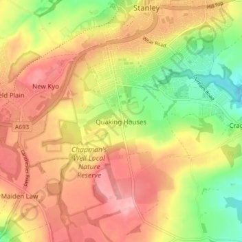
Name: Topografische Karte Quaking Houses, Höhe, Relief.
Durchschnittliche Höhe: 206 m
Minimale Höhe: 131 m
Maximale Höhe: 266 m
Andere topografische Karten
Klicken Sie auf eine Karte, um ihre Topografie, ihre Höhe und ihr Relief anzuzeigen.
Oakey's Park
United Kingdom > England > County Durham > Stanley > West Shield Row Villas
Durchschnittliche Höhe: 182 m