
Topografische Karte Jadcherla
Interaktive Karte
Klicken Sie auf die Karte, um die Höhe anzuzeigen.
Über diese Karte
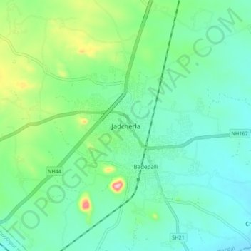
Name: Topografische Karte Jadcherla, Höhe, Relief.
Durchschnittliche Höhe: 552 m
Minimale Höhe: 503 m
Maximale Höhe: 703 m
Jadcherla is located at 16°46′26″N 78°08′12″E / 16.7738°N 78.1367°E / 16.7738; 78.1367 and at an altitude of 14 m (46 ft). The town is spread over an area of 550 km2 (210 sq mi). Jadcherla is located 86 km from Hyderabad 130km from Kurnool and 21 km from Mahabubnagar.