Geolokalisieren

Topografische Karte 宫村镇

Interaktive Karte

Klicken Sie auf die Karte, um die Höhe anzuzeigen.

Über diese Karte

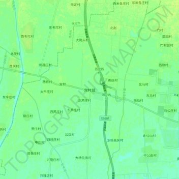
Name: Topografische Karte 宫村镇, Höhe, Relief.

Ort: 宫村镇, 廊坊市, 河北省, 中国 (39.42669 116.14392 39.50669 116.22392)

Durchschnittliche Höhe: 28 m

Minimale Höhe: 21 m

Maximale Höhe: 34 m

Andere topografische Karten

Klicken Sie auf eine Karte, um ihre Topografie, ihre Höhe und ihr Relief anzuzeigen.

格达村

中国 > 河北省 > 廊坊市

格达村, 廊坊市, 河北省, 中国

Durchschnittliche Höhe: 7 m

孟村

中国 > 河北省 > 廊坊市

孟村, 廊坊市, 河北省, 中国

Durchschnittliche Höhe: 6 m

大杨先务村

中国 > 河北省 > 廊坊市

大杨先务村, 廊坊市, 河北省, 中国

Durchschnittliche Höhe: 26 m

九州镇

中国 > 河北省 > 廊坊市

九州镇, 广阳区, 廊坊市, 河北省, 中国

Durchschnittliche Höhe: 21 m

大厂回族自治县

中国 > 河北省 > 廊坊市

大厂回族自治县, 廊坊市, 河北省, 中国

Durchschnittliche Höhe: 20 m

韩家庄村

中国 > 河北省 > 廊坊市

韩家庄村, 廊坊市, 河北省, 中国

Durchschnittliche Höhe: 28 m

潮白河

中国 > 河北省 > 廊坊市

潮白河, 大厂回族自治县, 廊坊市, 河北省, 中国

Durchschnittliche Höhe: 18 m

香河县

中国 > 河北省 > 廊坊市

香河县, 廊坊市, 河北省, 065400, 中国

Durchschnittliche Höhe: 13 m

霸州市

中国 > 河北省 > 廊坊市

霸州市, 廊坊市, 河北省, 中国

Durchschnittliche Höhe: 9 m

文安县

中国 > 河北省 > 廊坊市

文安县, 廊坊市, 河北省, 中国

Durchschnittliche Höhe: 7 m

广阳区

中国 > 河北省 > 廊坊市

广阳区, 廊坊市, 河北省, 102802, 中国

Durchschnittliche Höhe: 16 m

固安县

中国 > 河北省 > 廊坊市

固安县, 廊坊市, 河北省, 中国

Durchschnittliche Höhe: 20 m

崔各寨二村

中国 > 河北省 > 廊坊市 > 崔各寨二村

崔各寨二村, 三河市, 廊坊市, 河北省, 中国

Durchschnittliche Höhe: 47 m

南马村

中国 > 河北省 > 廊坊市 > 南马村

南马村, 廊坊市, 河北省, 中国

Durchschnittliche Höhe: 27 m

南尖塔镇

中国 > 河北省 > 廊坊市 > 南尖塔镇

南尖塔镇, 广阳区, 廊坊市, 河北省, 中国

Durchschnittliche Höhe: 18 m