Geolokalisieren

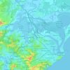
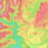
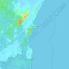
Topografische Karte Hunter Valley

Klicken Sie auf die Karte, um die Höhe anzuzeigen.

Über diese Karte

Name: Topografische Karte Hunter Valley, Höhe, Relief.

Ort: Hunter Valley, Singleton Council, New South Wales, Australia (-32.54223 151.21851 -32.54213 151.21861)

Durchschnittliche Höhe: 80 m

Minimale Höhe: 54 m

Maximale Höhe: 114 m

Andere topografische Karten

Klicken Sie auf eine Karte, um ihre Topografie, ihre Höhe und ihr Relief anzuzeigen.
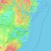
Sydney

Australia > New South Wales

Sydney's topography is characterized by a diverse landscape that seamlessly blends coastal features with inland plateaus. The city is divided into two primary regions: the relatively flat Cumberland Plain to the south and west of Sydney Harbour, and the elevated Hornsby Plateau to the north. The Cumberland…

Durchschnittliche Höhe: 51 m
Newcastle

Australia > New South Wales > Newcastle

Durchschnittliche Höhe: 5 m

Centennial Park

Australia > New South Wales > Sydney

Durchschnittliche Höhe: 51 m

Gilgandra Shire Council

Australia > New South Wales

Durchschnittliche Höhe: 349 m

Port Macquarie

Australia > New South Wales

Durchschnittliche Höhe: 5 m

Orange

Australia > New South Wales

Orange is a city in the Central Tablelands region of New South Wales, Australia. It is 254 km (158 mi) west of the state capital, Sydney [206 km (128 mi) on a great circle], at an altitude of 862 metres (2,828 ft). Orange had an estimated urban population of 40,493 as of June 2018 making the city a significant…

Durchschnittliche Höhe: 852 m
Parramatta

Australia > New South Wales

Durchschnittliche Höhe: 22 m

Sydney

Australia > New South Wales > Sydney

Durchschnittliche Höhe: 23 m

Mascot

Australia > New South Wales > Sydney

Durchschnittliche Höhe: 8 m

Manly

Australia > New South Wales

Durchschnittliche Höhe: 17 m

Narrandera Shire Council

Australia > New South Wales

Durchschnittliche Höhe: 186 m

Cooranbong

Australia > New South Wales

Durchschnittliche Höhe: 72 m

Byron Bay

Australia > New South Wales

Byron Bay, located in northeastern New South Wales, Australia, is characterized by diverse topography shaped by its geological history. The town is part of the erosion caldera of the ancient Tweed Volcano, which erupted approximately 23 million years ago, resulting in the rich volcanic soils that define the…

Durchschnittliche Höhe: 7 m
Kosciuszko National Park

Australia > New South Wales

Durchschnittliche Höhe: 883 m

Five Dock

Australia > New South Wales

Durchschnittliche Höhe: 12 m

Inverell Shire Council

Australia > New South Wales

Durchschnittliche Höhe: 656 m

Ocean Shores

Australia > New South Wales

Durchschnittliche Höhe: 12 m

Marrickville

Australia > New South Wales > Sydney

Durchschnittliche Höhe: 17 m

Nimmitabel

Australia > New South Wales

Durchschnittliche Höhe: 1.051 m

Newcastle City Council

Australia > New South Wales

Durchschnittliche Höhe: 18 m

Kingscliff

Australia > New South Wales

Durchschnittliche Höhe: 5 m

Boggabri

Australia > New South Wales

Durchschnittliche Höhe: 301 m

Blue Mountains

Australia > New South Wales

A sandstone plateau dominated by a landscape of endless eucalyptus forests, the Blue Mountains are located at the top of a 470-million-year-old quartzite. In the Permian period, a shallow sea covered the region, when rivers brought shales, siltstones and mudstones. Then during the Mesozoic period, rivers…

Durchschnittliche Höhe: 566 m

Midginbil

Australia > New South Wales

Durchschnittliche Höhe: 266 m

Spring Ridge

Australia > New South Wales

Durchschnittliche Höhe: 344 m

Sherwood

Australia > New South Wales

Durchschnittliche Höhe: 30 m

Sutton

Australia > New South Wales

Durchschnittliche Höhe: 687 m

Mount Hope

Australia > New South Wales

Durchschnittliche Höhe: 213 m

Calga

Australia > New South Wales

Durchschnittliche Höhe: 138 m

Central Coast Council

Australia > New South Wales

Durchschnittliche Höhe: 103 m

Iluka

Australia > New South Wales

Durchschnittliche Höhe: 2 m

Bowral

Australia > New South Wales

Durchschnittliche Höhe: 690 m

Lismore City Council

Australia > New South Wales

Durchschnittliche Höhe: 83 m

Belrose

Australia > New South Wales > Sydney

Durchschnittliche Höhe: 124 m

Toukley

Australia > New South Wales

Durchschnittliche Höhe: 3 m

Tweed Shire Council

Australia > New South Wales

Durchschnittliche Höhe: 212 m

Medowie

Australia > New South Wales

Durchschnittliche Höhe: 16 m

Carlingford

Australia > New South Wales > Sydney

Durchschnittliche Höhe: 98 m

Manly Vale

Australia > New South Wales > Sydney

Durchschnittliche Höhe: 34 m

Mona Vale

Australia > New South Wales > Sydney

Durchschnittliche Höhe: 20 m

Sutherland Shire Council

Australia > New South Wales

Durchschnittliche Höhe: 79 m

Moree

Australia > New South Wales

Durchschnittliche Höhe: 216 m

Mudgee

Australia > New South Wales

Durchschnittliche Höhe: 535 m

Blacktown City Council

Australia > New South Wales

Durchschnittliche Höhe: 47 m

Taree

Australia > New South Wales

Durchschnittliche Höhe: 17 m

Rose Bay

Australia > New South Wales > Sydney

Durchschnittliche Höhe: 31 m

Blue Mountains National Park

Australia > New South Wales

Durchschnittliche Höhe: 456 m

Parramatta River

Australia > New South Wales > Sydney > Parramatta

Durchschnittliche Höhe: 43 m

Ryde

Australia > New South Wales > Sydney

Durchschnittliche Höhe: 52 m

Box Hill

Australia > New South Wales > Sydney

Durchschnittliche Höhe: 45 m

Lismore

Australia > New South Wales

Durchschnittliche Höhe: 23 m

Upper North Shore

Australia > New South Wales > Sydney

Durchschnittliche Höhe: 119 m

Beechwood

Australia > New South Wales

Durchschnittliche Höhe: 28 m

Webbs Creek

Australia > New South Wales

Durchschnittliche Höhe: 123 m

Milton

Australia > New South Wales

Durchschnittliche Höhe: 33 m

Stuarts Point

Australia > New South Wales

Durchschnittliche Höhe: 9 m

Bannaby

Australia > New South Wales

Durchschnittliche Höhe: 667 m

Revesby Flood Reserve

Australia > New South Wales > Sydney

Durchschnittliche Höhe: 22 m

Legume

Australia > New South Wales

Durchschnittliche Höhe: 517 m

Tuggerawong

Australia > New South Wales

Durchschnittliche Höhe: 3 m

Narromine Shire Council

Australia > New South Wales

Durchschnittliche Höhe: 244 m

The Rock

Australia > New South Wales

Durchschnittliche Höhe: 229 m

Capertee

Australia > New South Wales

Durchschnittliche Höhe: 757 m

Yass

Australia > New South Wales

Yass is located 280 km south-west of Sydney, on the Hume Highway. The Yass River, which is a tributary of the Murrumbidgee River, flows through the town. Yass is 59 km from Canberra; lying at an elevation of 505 m AMSL.

Durchschnittliche Höhe: 533 m
Goulburn

Australia > New South Wales

Owing to its elevation, Goulburn has an oceanic climate (Cfb) with warm summers and cool winters; with a high diurnal range. Its climate is variable much of the year, though generally dry with maximum temperatures ranging from 11.8 °C (53.2 °F) in July to 28.3 °C (82.9 °F) in January. Rainfall is…

Durchschnittliche Höhe: 666 m
Bathurst Regional Council

Australia > New South Wales

Durchschnittliche Höhe: 845 m

Tenterfield Shire Council

Australia > New South Wales

Durchschnittliche Höhe: 565 m

Forbes Shire Council

Australia > New South Wales

Durchschnittliche Höhe: 291 m

Lithgow City Council

Australia > New South Wales

Durchschnittliche Höhe: 713 m

Blaxland

Australia > New South Wales

Durchschnittliche Höhe: 214 m

Umina Beach

Australia > New South Wales

Durchschnittliche Höhe: 38 m

Petersham

Australia > New South Wales > Sydney

Durchschnittliche Höhe: 26 m

Coogee

Australia > New South Wales

Durchschnittliche Höhe: 35 m

Wauchope

Australia > New South Wales

Durchschnittliche Höhe: 32 m

Kanangra-Boyd National Park

Australia > New South Wales

Durchschnittliche Höhe: 747 m

Kincumba Mountain Reserve

Australia > New South Wales > Gosford

Durchschnittliche Höhe: 38 m

Crescent Head

Australia > New South Wales

Durchschnittliche Höhe: 7 m

Clarence Valley Council

Australia > New South Wales

Durchschnittliche Höhe: 357 m

Morton National Park

Australia > New South Wales

Durchschnittliche Höhe: 427 m

Guthega

Australia > New South Wales

Durchschnittliche Höhe: 1.743 m

Balmoral Village

Australia > New South Wales

Durchschnittliche Höhe: 442 m

Dorrigo

Australia > New South Wales

Durchschnittliche Höhe: 743 m

Nana Glen

Australia > New South Wales

Durchschnittliche Höhe: 140 m

Hill End

Australia > New South Wales

Durchschnittliche Höhe: 738 m

Cooma

Australia > New South Wales

Durchschnittliche Höhe: 869 m

Junee

Australia > New South Wales

Durchschnittliche Höhe: 326 m

Fingal Head

Australia > New South Wales

Durchschnittliche Höhe: 4 m

Macleay River

Australia > New South Wales

Durchschnittliche Höhe: 308 m

Shoalhaven River

Australia > New South Wales

Durchschnittliche Höhe: 453 m

Eureka

Australia > New South Wales

Durchschnittliche Höhe: 83 m

Wooli

Australia > New South Wales

Durchschnittliche Höhe: 9 m

Gundagai

Australia > New South Wales

Gundagai is an inland town with an elevation of 232 metres (761 ft). Almost all of the shire is located in the South West Slopes bio-region and is part of the Riverina agricultural region. The eastern part of the shire is considered part of the South Eastern Highlands bioregion.

Durchschnittliche Höhe: 309 m

Stokers Siding

Australia > New South Wales

Durchschnittliche Höhe: 98 m

Wilsons River

Australia > New South Wales

Durchschnittliche Höhe: 84 m

Bowan Park

Australia > New South Wales

Durchschnittliche Höhe: 605 m

Rüste dich für dein nächstes Abenteuer:

🦯Wanderstöcke - Gelenkschonende Unterstützung auf steilen Wegen
⛺Ultraleichtes Trekkingzelt - Ideale Unterkunft für Mehrtagestouren im Gelände
🧉Isolierflasche 1 Liter - Hält Getränke im Winter warm und im Sommer kühl
⛺Notfall-Biwaksack - Lebenswichtiger Schutz bei unvorhergesehener Übernachtung am Berg
🔦LED Campinglaterne - Rundum-Beleuchtung für das Zelt oder den Lagerplatz

Als Amazon-Partner verdient diese Website an qualifizierten Käufen, ohne zusätzliche Kosten für Sie.