
Topografische Karte Great Falls
Interaktive Karte
Klicken Sie auf die Karte, um die Höhe anzuzeigen.
Über diese Karte
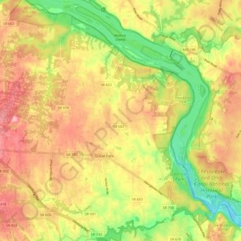
Name: Topografische Karte Great Falls, Höhe, Relief.
Ort: Great Falls, Fairfax County, Virginia, 22066, United States (38.96603 -77.34136 39.05700 -77.23491)
Durchschnittliche Höhe: 88 m
Minimale Höhe: 16 m
Maximale Höhe: 148 m
Great Falls is located at 38°59′53″N 077°17′18″W / 38.99806°N 77.28833°W / 38.99806; -77.28833 (38.9981653, −77.2883157) at an elevation of 344 feet (105 m). Located on Virginia State Route 7 in Northern Virginia, Great Falls is 15 miles (24 km) west-northwest of downtown Washington, D.C. and 10.5 miles (16.9 km) north of Fairfax, the county seat.