
Topografische Karte Sugar Mountain
Interaktive Karte
Klicken Sie auf die Karte, um die Höhe anzuzeigen.
Über diese Karte
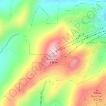
Name: Topografische Karte Sugar Mountain, Höhe, Relief.
Durchschnittliche Höhe: 1.385 m
Minimale Höhe: 1.211 m
Maximale Höhe: 1.584 m
Sugar Mountain is a mountain in the North Carolina High Country and wholly in the Pisgah National Forest. Its elevation reaches 5,236 feet (1,596 m) and is split along the Eastern Continental Divide, generating feeder streams for the Linville, Elk, and North Toe rivers. On its north slope resides the Village of Sugar Mountain.