
Topografische Karte West Rutland
Interaktive Karte
Klicken Sie auf die Karte, um die Höhe anzuzeigen.
West Rutland
The town of Rutland was originally granted in 1761 as one of the New Hampshire Grants and named after Rutland, Massachusetts, the home of the first grantee, John Murrey. It was one of the most successful of those grants because of excellent farmland and gentle topography.
Über diese Karte
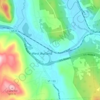
Name: Topografische Karte West Rutland, Höhe, Relief.
Ort: West Rutland, Rutland County, Vermont, 05777, United States (43.57037 -73.06800 43.61950 -73.02223)
Durchschnittliche Höhe: 233 m
Minimale Höhe: 141 m
Maximale Höhe: 502 m