
Topografische Karte Orange River
Interaktive Karte
Klicken Sie auf die Karte, um die Höhe anzuzeigen.
Über diese Karte
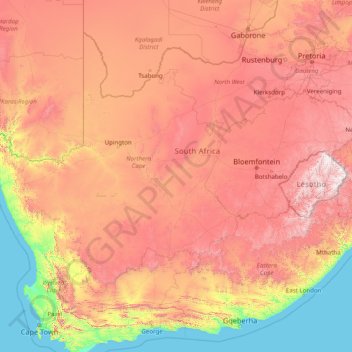
Name: Topografische Karte Orange River, Höhe, Relief.
Ort: Orange River, 8850, South Africa (-30.69413 16.44945 -28.03360 29.07203)
Durchschnittliche Höhe: 967 m
Minimale Höhe: 0 m
Maximale Höhe: 3.373 m
During the temperate months of March and April, given good rains and the sluices of the dams being open, a canoeist (or rafter) can easily travel 30 km per day. The lower reaches of the river are most popular, because of the spectacular topography. Commercial tours are available, and these expeditions depart from the border town of Vioolsdrif.
Andere topografische Karten
Klicken Sie auf eine Karte, um ihre Topografie, ihre Höhe und ihr Relief anzuzeigen.
Carnarvon
South Africa > Northern Cape > Pixley ka Seme District Municipality > Kareeberg Local Municipality
Carnarvon, Kareeberg Local Municipality, Pixley ka Seme District Municipality, Northern Cape, 8925, South Africa
Durchschnittliche Höhe: 1.272 m
Sol Plaatje Local Municipality
South Africa > Northern Cape > Frances Baard District Municipality
Sol Plaatje Local Municipality, Frances Baard District Municipality, Northern Cape, South Africa
Durchschnittliche Höhe: 1.122 m
Upington
South Africa > Northern Cape > ZF Mgcawu District Municipality
Upington, ǁKhara Hais Local Municipality, ZF Mgcawu District Municipality, Northern Cape, 8801, South Africa
Durchschnittliche Höhe: 849 m
Hopetown
South Africa > Northern Cape > Pixley ka Seme District Municipality > Thembelihle Local Municipality
Hopetown, Thembelihle Local Municipality, Pixley ka Seme District Municipality, Northern Cape, South Africa
Durchschnittliche Höhe: 1.101 m
Kimberley
South Africa > Northern Cape > Frances Baard District Municipality > Kimberley
Kimberley, Frances Baard District Municipality, Northern Cape, 8301, South Africa
Durchschnittliche Höhe: 1.191 m
Joe Morolong Local Municipality
South Africa > Northern Cape > Joe Morolong Local Municipality
Joe Morolong Local Municipality, John Taolo Gaetsewe District Municipality, Northern Cape, 8460, South Africa
Durchschnittliche Höhe: 1.074 m
Philipstown
South Africa > Northern Cape > Philipstown
Philipstown, Pixley ka Seme District Municipality, Northern Cape, South Africa
Durchschnittliche Höhe: 1.382 m
Mariba
South Africa > Northern Cape > Mariba
Mariba, John Taolo Gaetsewe District Municipality, Northern Cape, South Africa
Durchschnittliche Höhe: 1.390 m
Kimberley
South Africa > Northern Cape > Frances Baard District Municipality
Kimberley, Sol Plaatje Local Municipality, Frances Baard District Municipality, Northern Cape, South Africa
Durchschnittliche Höhe: 1.203 m
Springbok
South Africa > Northern Cape > Springbok
Springbok, Namakwa District Municipality, Northern Cape, 8240, South Africa
Durchschnittliche Höhe: 926 m