
Topografische Karte Chocorua
Interaktive Karte
Klicken Sie auf die Karte, um die Höhe anzuzeigen.
Über diese Karte
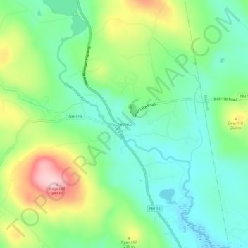
Name: Topografische Karte Chocorua, Höhe, Relief.
Durchschnittliche Höhe: 202 m
Minimale Höhe: 131 m
Maximale Höhe: 342 m
Andere topografische Karten
Klicken Sie auf eine Karte, um ihre Topografie, ihre Höhe und ihr Relief anzuzeigen.
Wonalancet
United States > New Hampshire > Carroll County > Tamworth
Wonalancet, Tamworth, Carroll County, New Hampshire, 03897, United States
Durchschnittliche Höhe: 391 m
South Tamworth
United States > New Hampshire > Carroll County > Tamworth
South Tamworth, Tamworth, Carroll County, New Hampshire, 03883, United States
Durchschnittliche Höhe: 265 m