
Topografische Karte Alta Vista
Interaktive Karte
Klicken Sie auf die Karte, um die Höhe anzuzeigen.
Über diese Karte
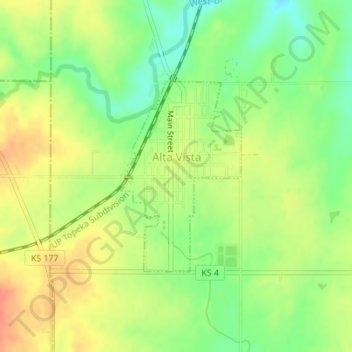
Name: Topografische Karte Alta Vista, Höhe, Relief.
Ort: Alta Vista, Wabaunsee County, Kansas, United States (38.85509 -96.49469 38.86970 -96.48283)
Durchschnittliche Höhe: 443 m
Minimale Höhe: 418 m
Maximale Höhe: 465 m
Alta Vista was founded in 1887, and it was incorporated as a city in 1905. Alta Vista is derived from the Spanish word for "high view", and the city was so named from its lofty elevation.
Andere topografische Karten
Klicken Sie auf eine Karte, um ihre Topografie, ihre Höhe und ihr Relief anzuzeigen.
McFarland
United States > Kansas > Wabaunsee County
McFarland, Wabaunsee County, Kansas, 66501, United States
Durchschnittliche Höhe: 320 m
Maple Hill
United States > Kansas > Wabaunsee County
Maple Hill, Wabaunsee County, Kansas, United States
Durchschnittliche Höhe: 298 m
Paxico
United States > Kansas > Wabaunsee County
Paxico, Wabaunsee County, Kansas, 66526, United States
Durchschnittliche Höhe: 310 m
Volland
United States > Kansas > Wabaunsee County
Volland, Wabaunsee County, Kansas, United States
Durchschnittliche Höhe: 387 m
Eskridge
United States > Kansas > Wabaunsee County
Eskridge, Wabaunsee County, Kansas, United States
Durchschnittliche Höhe: 437 m
Mount Mitchell Heritage Prairie Park
United States > Kansas > Wabaunsee County > Wamego
Mount Mitchell Heritage Prairie Park, 29377, Mitchell Prairie Lane, Wamego, Wabaunsee County, Kansas, 66547, United States
Durchschnittliche Höhe: 325 m
Harveyville
United States > Kansas > Wabaunsee County > Harveyville
Harveyville, Wabaunsee County, Kansas, United States
Durchschnittliche Höhe: 351 m
Alma
United States > Kansas > Wabaunsee County
Alma, Wabaunsee County, Kansas, United States
Durchschnittliche Höhe: 334 m