
Topografische Karte Ridgeland
Interaktive Karte
Klicken Sie auf die Karte, um die Höhe anzuzeigen.
Ridgeland
Ridgeland is in northeastern Jasper County, with the center of town sitting on a low ridge at an elevation of 62 feet (19 m) above sea level. According to the United States Census Bureau, the town has a total area of 44.7 square miles (115.8 km2), of which 44.4 square miles (115.1 km2) are land and 0.3 square miles (0.7 km2), or 0.59%, are water. The town's area as of 2010 is 18 times greater than its 2000 area of 2.4 square miles (6.3 km2). The town limits extend east into Beaufort County as far as the west bank of the Broad River.
Über diese Karte
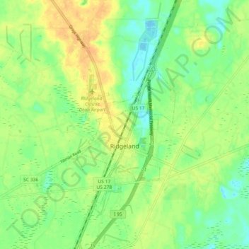
Name: Topografische Karte Ridgeland, Höhe, Relief.
Ort: Ridgeland, Jasper County, South Carolina, United States (32.44908 -80.99926 32.52542 -80.95989)
Durchschnittliche Höhe: 15 m
Minimale Höhe: -3 m
Maximale Höhe: 32 m