

Topografische Karte Dundas
Klicken Sie auf die Karte, um die Höhe anzuzeigen.
Dundas
Dundas /ˈdʌnˌdæs/ is a community and former town in Hamilton, Ontario, Canada. It is nicknamed the Valley Town because of its topographical location at the bottom of the Niagara Escarpment on the western edge of Lake Ontario. The population has been stable for decades at about twenty thousand, largely because it has not annexed rural land from the protected Dundas Valley Conservation Area.
Über diese Karte
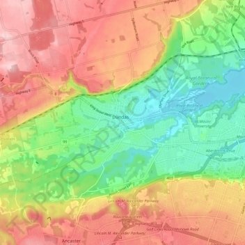
Name: Topografische Karte Dundas, Höhe, Relief.
Ort: Dundas, Hamilton, Golden Horseshoe, Ontario, L9H 1T5, Canada (43.22619 -79.99463 43.30619 -79.91463)
Durchschnittliche Höhe: 171 m
Minimale Höhe: 72 m
Maximale Höhe: 273 m