
Topografische Karte Macdonald-Cartier Freeway
Interaktive Karte
Klicken Sie auf die Karte, um die Höhe anzuzeigen.
Über diese Karte
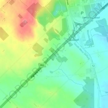
Name: Topografische Karte Macdonald-Cartier Freeway, Höhe, Relief.
Durchschnittliche Höhe: 326 m
Minimale Höhe: 291 m
Maximale Höhe: 388 m