
Topografische Karte Meredith
Interaktive Karte
Klicken Sie auf die Karte, um die Höhe anzuzeigen.
Über diese Karte
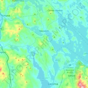
Name: Topografische Karte Meredith, Höhe, Relief.
Durchschnittliche Höhe: 215 m
Minimale Höhe: 142 m
Maximale Höhe: 718 m
According to the United States Census Bureau, the town has a total area of 54.2 square miles (140.4 km2), of which 39.9 square miles (103.4 km2) is land and 14.3 square miles (37.0 km2) or 26.37% is water. The highest point in Meredith is the summit of Leavitt Mountain, elevation 1,414 feet (431 m) above sea level, in the southwestern part of town.