
Topografische Karte Pulilan
Interaktive Karte
Klicken Sie auf die Karte, um die Höhe anzuzeigen.
Über diese Karte
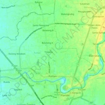
Name: Topografische Karte Pulilan, Höhe, Relief.
Ort: Pulilan, Bulacan, Central Luzon, 3005, Philippines (14.88783 120.79772 14.95701 120.89039)
Durchschnittliche Höhe: 10 m
Minimale Höhe: 0 m
Maximale Höhe: 22 m
The municipality is generally of flat topography. Eleven (11) of its barangays are bounded by the Angat River. The rest are flat irrigated rice lands. Soil types vary from sandy loam to clay loam which makes the municipality suitable to a wide range of agricultural products.
Andere topografische Karten
Klicken Sie auf eine Karte, um ihre Topografie, ihre Höhe und ihr Relief anzuzeigen.
Pulilan
Philippines > Bulacan > Pulilan
Pulilan, Bulacan, Central Luzon, 3005, Philippines
Durchschnittliche Höhe: 9 m