Topografische Karte Cedar Mill
Interaktive Karte
Klicken Sie auf die Karte, um die Höhe anzuzeigen.
Über diese Karte
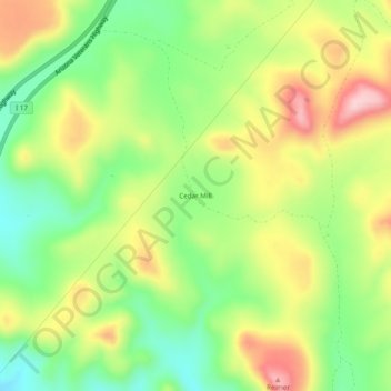
Name: Topografische Karte Cedar Mill, Höhe, Relief.
Durchschnittliche Höhe: 1.415 m
Minimale Höhe: 1.313 m
Maximale Höhe: 1.540 m

Klicken Sie auf die Karte, um die Höhe anzuzeigen.
Name: Topografische Karte Cedar Mill, Höhe, Relief.
Durchschnittliche Höhe: 1.415 m
Minimale Höhe: 1.313 m
Maximale Höhe: 1.540 m