
Topografische Karte Aungpan
Interaktive Karte
Klicken Sie auf die Karte, um die Höhe anzuzeigen.
Über diese Karte
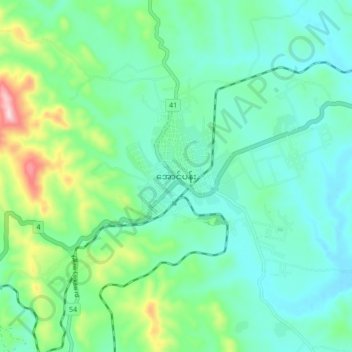
Name: Topografische Karte Aungpan, Höhe, Relief.
Durchschnittliche Höhe: 1.329 m
Minimale Höhe: 1.248 m
Maximale Höhe: 1.598 m
Aungpan (Burmese: အောင်ပန်းမြို့) is a town located in the Southern Shan State. It is located in Kalaw Township which is part of Taunggyi District. It lies on the Thazi-Kyaingtong road at an elevation of 4219 feet (1286 meters) above sea level.