
Topografische Karte Colington
Interaktive Karte
Klicken Sie auf die Karte, um die Höhe anzuzeigen.
Über diese Karte
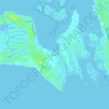
Name: Topografische Karte Colington, Höhe, Relief.
Ort: Colington, Dare County, North Carolina, 27948, United States (35.98794 -75.72157 36.02794 -75.68157)
Durchschnittliche Höhe: 1 m
Minimale Höhe: -4 m
Maximale Höhe: 15 m
Andere topografische Karten
Klicken Sie auf eine Karte, um ihre Topografie, ihre Höhe und ihr Relief anzuzeigen.
Dare County
United States > North Carolina > Dare County
Dare County, North Carolina, United States
Durchschnittliche Höhe: 1 m
Outer Banks
United States > North Carolina > Dare County
Outer Banks, Dare County, North Carolina, 27982, United States
Durchschnittliche Höhe: 0 m
Kill Devil Hills
United States > North Carolina > Dare County > Kill Devil Hills
Kill Devil Hills, Dare County, North Carolina, United States
Durchschnittliche Höhe: 2 m