
Topografische Karte المعامل الحكومية
Interaktive Karte
Klicken Sie auf die Karte, um die Höhe anzuzeigen.
Über diese Karte
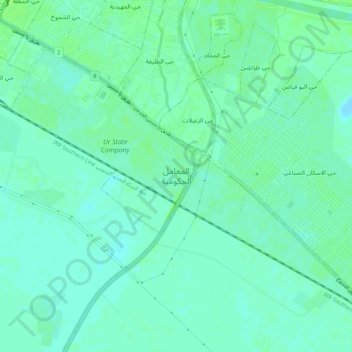
Name: Topografische Karte المعامل الحكومية, Höhe, Relief.
Durchschnittliche Höhe: 5 m
Minimale Höhe: -2 m
Maximale Höhe: 9 m
Andere topografische Karten
Klicken Sie auf eine Karte, um ihre Topografie, ihre Höhe und ihr Relief anzuzeigen.
Al-Dawayah District
Al-Dawayah District, Dhi Qar Governorate, 64012, Iraq
Durchschnittliche Höhe: 8 m
Al-Rifa'i District
Al-Rifa'i District, Dhi Qar Governorate, Iraq
Durchschnittliche Höhe: 9 m
Al Batha
Al Batha, Al-Batha Subdistrict, Al-Nasiriyah District, Dhi Qar Governorate, Iraq
Durchschnittliche Höhe: 8 m
Tell el-'Oueili
Iraq > Dhi Qar Governorate > Al-Rifa'i District
Tell el-'Oueili, الطريق بغداد - البصرة, Al-Nasr Subdistrict, Al-Rifa'i District, Al-Batha Subdistrict, Al-Nasiriyah District, Dhi Qar Governorate, Iraq
Durchschnittliche Höhe: 7 m
Euphrates
Iraq > Dhi Qar Governorate > Nasiriyah
Euphrates, Nasiriyah, Al-Nasiriyah Central Subdistrict, Al-Nasiriyah District, Dhi Qar Governorate, Iraq
Durchschnittliche Höhe: 6 m
Qaryat al Karush
Iraq > Dhi Qar Governorate > Qaryat al Karush
Qaryat al Karush, Al-Nasiriyah Central Subdistrict, Al-Nasiriyah District, Dhi Qar Governorate, Iraq
Durchschnittliche Höhe: 5 m
Jamaat ash Shaykh
Iraq > Dhi Qar Governorate > Harran as Sajit > Jamaat ash Shaykh
Jamaat ash Shaykh, Harran as Sajit, Al-Dawayah Central Subdistrict, Al-Dawayah District, Dhi Qar Governorate, Iraq
Durchschnittliche Höhe: 7 m
Al Kurmashiyah ash Sharqiyah
Iraq > Dhi Qar Governorate > Al Kurmashiyah ash Sharqiyah
Al Kurmashiyah ash Sharqiyah, Karmat Bani Saad Subdsitrict, Sooq Ash-Shuyookh District, Dhi Qar Governorate, Iraq
Durchschnittliche Höhe: 4 m