
Topografische Karte Volcán Aucanquilcha
Interaktive Karte
Klicken Sie auf die Karte, um die Höhe anzuzeigen.
Volcán Aucanquilcha
At Aucanquilcha volcano there is some fumarolic activity, and sulfur deposits are found at the summit. Several sulfur mines lie in the complex. One mine at an altitude of 5,950 metres (19,520 ft) was opened in 1913 and remained in use from 1950 to 1992. It was the world's highest mine during that period. Originally, sulfur obtained at the mine was transported down with llamas. Subsequently, an aerial cableway was employed to transport the sulfur to the town of Amincha. To bring the sulfur down, a road network to the summit was constructed in 1972, although it is now impassable.
Über diese Karte
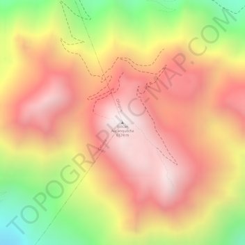
Name: Topografische Karte Volcán Aucanquilcha, Höhe, Relief.
Durchschnittliche Höhe: 5.808 m
Minimale Höhe: 5.202 m
Maximale Höhe: 6.177 m