

Topografische Karte Morelia
Klicken Sie auf die Karte, um die Höhe anzuzeigen.
Morelia
Under the Köppen climate classification, Morelia has a subtropical highland climate (abbreviated Cwb on climate maps), with warm-to-hot days and cool nights year round due to its high elevation. Most precipitation falls during the summer monsoon season from June to September. Average monthly temperatures are between 14 and 22 °C (57 and 72 °F), with maximum temperatures of 38.3 °C (100.9 °F) in the summer of 1998 and the lowest temperature of −5.2 °C (22.6 °F) in January 1985.
Über diese Karte
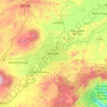
Name: Topografische Karte Morelia, Höhe, Relief.
Ort: Morelia, Michoacán, 58000, Mexico (19.54271 -101.35238 19.86271 -101.03238)
Durchschnittliche Höhe: 2.071 m
Minimale Höhe: 1.323 m
Maximale Höhe: 2.989 m