Geolokalisieren

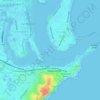
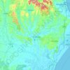
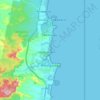
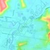
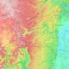
Topografische Karte Cabbage Tree Harbour

Klicken Sie auf die Karte, um die Höhe anzuzeigen.

Über diese Karte

Name: Topografische Karte Cabbage Tree Harbour, Höhe, Relief.

Ort: Cabbage Tree Harbour, New South Wales, 2263, Australia (-33.27749 151.56740 -33.27739 151.56750)

Durchschnittliche Höhe: 10 m

Minimale Höhe: 0 m

Maximale Höhe: 39 m

Andere topografische Karten

Klicken Sie auf eine Karte, um ihre Topografie, ihre Höhe und ihr Relief anzuzeigen.
Sydney

Australia > New South Wales

Sydney's topography is characterized by a diverse landscape that seamlessly blends coastal features with inland plateaus. The city is divided into two primary regions: the relatively flat Cumberland Plain to the south and west of Sydney Harbour, and the elevated Hornsby Plateau to the north. The Cumberland…

Durchschnittliche Höhe: 51 m
Bowral

Australia > New South Wales

Durchschnittliche Höhe: 690 m

Newcastle

Australia > New South Wales > Newcastle

Durchschnittliche Höhe: 5 m

Castle Hill

Australia > New South Wales

Durchschnittliche Höhe: 123 m

Lindfield

Australia > New South Wales > Sydney

Durchschnittliche Höhe: 79 m

Yass

Australia > New South Wales

Yass is located 280 km south-west of Sydney, on the Hume Highway. The Yass River, which is a tributary of the Murrumbidgee River, flows through the town. Yass is 59 km from Canberra; lying at an elevation of 505 m AMSL.

Durchschnittliche Höhe: 533 m
Tenterfield Shire Council

Australia > New South Wales

Durchschnittliche Höhe: 565 m

Orange

Australia > New South Wales

Orange is a city in the Central Tablelands region of New South Wales, Australia. It is 254 km (158 mi) west of the state capital, Sydney [206 km (128 mi) on a great circle], at an altitude of 862 metres (2,828 ft). Orange had an estimated urban population of 40,493 as of June 2018 making the city a significant…

Durchschnittliche Höhe: 852 m
Byron Bay

Australia > New South Wales

Byron Bay, located in northeastern New South Wales, Australia, is characterized by diverse topography shaped by its geological history. The town is part of the erosion caldera of the ancient Tweed Volcano, which erupted approximately 23 million years ago, resulting in the rich volcanic soils that define the…

Durchschnittliche Höhe: 7 m
Newcastle City Council

Australia > New South Wales

Durchschnittliche Höhe: 18 m

Blue Mountains

Australia > New South Wales

A sandstone plateau dominated by a landscape of endless eucalyptus forests, the Blue Mountains are located at the top of a 470-million-year-old quartzite. In the Permian period, a shallow sea covered the region, when rivers brought shales, siltstones and mudstones. Then during the Mesozoic period, rivers…

Durchschnittliche Höhe: 566 m

Bucca

Australia > New South Wales

Durchschnittliche Höhe: 122 m

Iluka

Australia > New South Wales

Durchschnittliche Höhe: 2 m

Girvan

Australia > New South Wales

Durchschnittliche Höhe: 99 m

Lismore City Council

Australia > New South Wales

Durchschnittliche Höhe: 83 m

Blackheath

Australia > New South Wales

Blackheath (postcode: 2785) is an Australian town located near the highest point of the Blue Mountains, between Katoomba and Mount Victoria in New South Wales. The town's altitude is about 1,065 metres (3,494 ft) AHD  and it is located about 120 kilometres (75 mi) west north-west of Sydney, 11 kilometres…

Durchschnittliche Höhe: 893 m
Moss Vale

Australia > New South Wales

Durchschnittliche Höhe: 673 m

Pittwater

Australia > New South Wales

Durchschnittliche Höhe: 45 m

Willoughby City Council

Australia > New South Wales

Durchschnittliche Höhe: 60 m

Wauchope

Australia > New South Wales

Durchschnittliche Höhe: 32 m

North Rothbury

Australia > New South Wales

Durchschnittliche Höhe: 66 m

Bega Valley Shire Council

Australia > New South Wales

Durchschnittliche Höhe: 370 m

Abermain

Australia > New South Wales

Durchschnittliche Höhe: 57 m

Luddenham

Australia > New South Wales

Durchschnittliche Höhe: 72 m

Carrington

Australia > New South Wales > Newcastle

Durchschnittliche Höhe: 3 m

Timbarra

Australia > New South Wales

Durchschnittliche Höhe: 810 m

Shelly Beach

Australia > New South Wales

Durchschnittliche Höhe: 9 m

Delegate

Australia > New South Wales

Durchschnittliche Höhe: 841 m

Glen Innes

Australia > New South Wales

Durchschnittliche Höhe: 1.083 m

Mudgee

Australia > New South Wales

Durchschnittliche Höhe: 535 m

Shoalhaven City Council

Australia > New South Wales

Durchschnittliche Höhe: 272 m

Berkeley

Australia > New South Wales > Wollongong City Council

Durchschnittliche Höhe: 18 m

Moruya

Australia > New South Wales

Durchschnittliche Höhe: 37 m

Calderwood

Australia > New South Wales

Durchschnittliche Höhe: 100 m

Bathurst Regional Council

Australia > New South Wales

Durchschnittliche Höhe: 845 m

Randwick

Australia > New South Wales > Sydney

Durchschnittliche Höhe: 44 m

Liverpool

Australia > New South Wales > Sydney

Durchschnittliche Höhe: 14 m

Wentworth Falls

Australia > New South Wales > Sydney

Wentworth Falls (postcode: 2782) is a town in the Blue Mountains region of New South Wales, situated approximately 100 kilometres (62 mi) west of the Sydney central business district, and about 8 kilometres (5.0 mi) east of Katoomba, Australia on the Great Western Highway, with a Wentworth Falls railway…

Durchschnittliche Höhe: 708 m
Illawarra

Australia > New South Wales

Durchschnittliche Höhe: 234 m

Ryde

Australia > New South Wales > Sydney

Durchschnittliche Höhe: 52 m

Bouddi National Park

Australia > New South Wales > Gosford

Durchschnittliche Höhe: 21 m

Elermore Vale

Australia > New South Wales > Newcastle

Durchschnittliche Höhe: 43 m

Rouse Hill

Australia > New South Wales > Sydney

Durchschnittliche Höhe: 51 m

Black Springs

Australia > New South Wales

Durchschnittliche Höhe: 1.157 m

Woodberry

Australia > New South Wales > Newcastle-Maitland

Durchschnittliche Höhe: 6 m

Elsmore

Australia > New South Wales

Durchschnittliche Höhe: 730 m

Woy Woy

Australia > New South Wales

Durchschnittliche Höhe: 35 m

Mascot

Australia > New South Wales > Sydney

Durchschnittliche Höhe: 8 m

Woolgoolga

Australia > New South Wales

Durchschnittliche Höhe: 29 m

Campsie

Australia > New South Wales

Durchschnittliche Höhe: 22 m

Laurieton

Australia > New South Wales

Durchschnittliche Höhe: 46 m

Bullocks Flat

Australia > New South Wales

Durchschnittliche Höhe: 1.197 m

Stanwell Tops

Australia > New South Wales

Durchschnittliche Höhe: 187 m

Bonalbo

Australia > New South Wales

Durchschnittliche Höhe: 263 m

Molong

Australia > New South Wales

Durchschnittliche Höhe: 595 m

Charlestown

Australia > New South Wales

Durchschnittliche Höhe: 71 m

Cowra

Australia > New South Wales

Durchschnittliche Höhe: 379 m

Kempsey

Australia > New South Wales

Durchschnittliche Höhe: 5 m

Lower North Shore

Australia > New South Wales > Sydney

Durchschnittliche Höhe: 45 m

Lochiel

Australia > New South Wales

Durchschnittliche Höhe: 135 m

Woodstock

Australia > New South Wales

Durchschnittliche Höhe: 501 m

Macleay River

Australia > New South Wales

Durchschnittliche Höhe: 308 m

Caffreys Flat

Australia > New South Wales

Durchschnittliche Höhe: 250 m

Wentworth

Australia > New South Wales

Durchschnittliche Höhe: 49 m

Majors Creek

Australia > New South Wales

Durchschnittliche Höhe: 648 m

Central Coast Council

Australia > New South Wales

Durchschnittliche Höhe: 103 m

Scotts Head

Australia > New South Wales

Durchschnittliche Höhe: 5 m

Parramatta

Australia > New South Wales

Durchschnittliche Höhe: 22 m

Goulburn

Australia > New South Wales

Owing to its elevation, Goulburn has an oceanic climate (Cfb) with warm summers and cool winters; with a high diurnal range. Its climate is variable much of the year, though generally dry with maximum temperatures ranging from 11.8 °C (53.2 °F) in July to 28.3 °C (82.9 °F) in January. Rainfall is…

Durchschnittliche Höhe: 666 m
Port Macquarie

Australia > New South Wales

Durchschnittliche Höhe: 5 m

Mollymook

Australia > New South Wales

Durchschnittliche Höhe: 24 m

Taree

Australia > New South Wales

Durchschnittliche Höhe: 17 m

Bega

Australia > New South Wales

Durchschnittliche Höhe: 44 m

Bundeena

Australia > New South Wales

Durchschnittliche Höhe: 20 m

Sussex Inlet

Australia > New South Wales > Sussex Inlet

Durchschnittliche Höhe: 10 m

Glen Davis

Australia > New South Wales

Durchschnittliche Höhe: 619 m

Walcha

Australia > New South Wales

Durchschnittliche Höhe: 956 m

Northern Beaches

Australia > New South Wales > Sydney

Durchschnittliche Höhe: 67 m

Lismore

Australia > New South Wales

Durchschnittliche Höhe: 23 m

East Maitland

Australia > New South Wales

Durchschnittliche Höhe: 23 m

North Rocks

Australia > New South Wales

Durchschnittliche Höhe: 80 m

Woombah

Australia > New South Wales

Durchschnittliche Höhe: 14 m

Wootton

Australia > New South Wales

Durchschnittliche Höhe: 102 m

Boxers Creek

Australia > New South Wales

Durchschnittliche Höhe: 689 m

The Entrance North

Australia > New South Wales

Durchschnittliche Höhe: 2 m

Geneva

Australia > New South Wales

Durchschnittliche Höhe: 95 m

Oxley Island

Australia > New South Wales

Durchschnittliche Höhe: 4 m

Griffith

Australia > New South Wales

Durchschnittliche Höhe: 131 m

Wingham

Australia > New South Wales

Durchschnittliche Höhe: 47 m

Goobarragandra

Australia > New South Wales

Durchschnittliche Höhe: 877 m

Barrington Tops

Australia > New South Wales

Durchschnittliche Höhe: 1.107 m

Coffs Harbour City Council

Australia > New South Wales

Durchschnittliche Höhe: 207 m

Singleton Council

Australia > New South Wales

Durchschnittliche Höhe: 238 m

Blue Mountains City Council

Australia > New South Wales

Durchschnittliche Höhe: 521 m

Crows Nest

Australia > New South Wales > Sydney

Durchschnittliche Höhe: 68 m

Council of the City of Ryde

Australia > New South Wales

Durchschnittliche Höhe: 48 m

Paddington

Australia > New South Wales

Paddington is a rare and largely intact example of an early Victorian residential suburb. Its unique qualities may be attributed to its close proximity to the city, the topography of its harbour location, the process of development and subdivision of early land grants, and the short period in the late l9thC in…

Durchschnittliche Höhe: 42 m

Inverell Shire Council

Australia > New South Wales

Durchschnittliche Höhe: 656 m

Mount Kuring-Gai

Australia > New South Wales > Sydney

Mount Kuring-gai is located approximately 7 km north of Hornsby. Its neighbouring suburbs are Berowra to the north, and Mount Colah to the south. Surrounded by bushland, it is bordered by Ku-ring-gai Chase National Park on the eastern side and by Berowra Valley Regional Park on the western side. There are…

Durchschnittliche Höhe: 133 m

Rüste dich für dein nächstes Abenteuer:

☕Gaskocher für Outdoor - Schnelle warme Mahlzeiten und Kaffee auf Tour
🔨Heringe für harten Boden - Sicherer Halt für das Zelt auch in felsigem Alpingelände
🔦LED Campinglaterne - Rundum-Beleuchtung für das Zelt oder den Lagerplatz
👟Wandersandalen - Bequemlichkeit für leichte Wege und Furten von Bächen
🗺️Topographische Karten - Detaillierte Karten für Berg- und Talregionen

Als Amazon-Partner verdient diese Website an qualifizierten Käufen, ohne zusätzliche Kosten für Sie.