

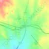
Topografische Karte Marfa
Klicken Sie auf die Karte, um die Höhe anzuzeigen.
Marfa
Marfa is a city in the high desert of the Trans-Pecos in far West Texas, United States, between the Davis Mountains and Big Bend National Park, at an elevation of 4685 feet. It is the county seat of Presidio County, and its population as of the 2020 United States Census was 1,788. The city was founded in the early 1880s as a water stop; the population peaked in the 1930s and has continued to decline each decade since. However, today Marfa is a tourist destination and a major center for minimalist art. Attractions include Building 98, the Chinati Foundation, artisan shops, historical architecture, a classic Texas town square, modern art installments, art galleries, and the Marfa lights.
Über diese Karte

Name: Topografische Karte Marfa, Höhe, Relief.
Ort: Marfa, Presidio County, Texas, 79843, United States (30.29697 -104.03859 30.32254 -104.01421)
Durchschnittliche Höhe: 1.434 m
Minimale Höhe: 1.420 m
Maximale Höhe: 1.456 m
Andere topografische Karten
Klicken Sie auf eine Karte, um ihre Topografie, ihre Höhe und ihr Relief anzuzeigen.
Marfa
United States > Texas > Presidio County > Marfa > Marfa
Marfa experiences a semi-arid climate (BSk) with hot summers and cool winters. Due to its elevation and aridity, the diurnal temperature variation is substantial.
Durchschnittliche Höhe: 1.448 m
