
Topografische Karte Gundagai
Interaktive Karte
Klicken Sie auf die Karte, um die Höhe anzuzeigen.
Gundagai
Gundagai is an inland town with an elevation of 250 metres (820 ft). Almost all of the shire is located in the South West Slopes bio-region and is part of the Riverina agricultural region. The eastern part of the shire is considered part of the South Eastern Highlands bioregion.
Über diese Karte
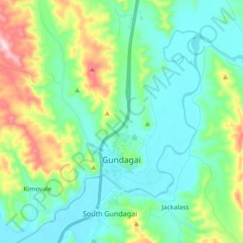
Name: Topografische Karte Gundagai, Höhe, Relief.
Durchschnittliche Höhe: 309 m
Minimale Höhe: 208 m
Maximale Höhe: 622 m