
Topografische Karte Farsala
Interaktive Karte
Klicken Sie auf die Karte, um die Höhe anzuzeigen.
Über diese Karte
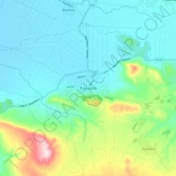
Name: Topografische Karte Farsala, Höhe, Relief.
Durchschnittliche Höhe: 215 m
Minimale Höhe: 122 m
Maximale Höhe: 523 m
The Pharsalos of the historic era was built over a hillside of the Narthacius mountains at an elevation of some 160 m, where modern Farsala stands. It was one of the main cities in Thessaly and was the capital of the Phthian tetrarch. It was also a polis (city-state).