
Topografische Karte Cinco
Interaktive Karte
Klicken Sie auf die Karte, um die Höhe anzuzeigen.
Über diese Karte
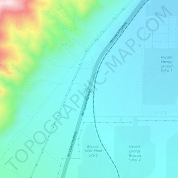
Name: Topografische Karte Cinco, Höhe, Relief.
Ort: Cinco, Kern County, California, United States (35.24330 -118.05618 35.28330 -118.01618)
Durchschnittliche Höhe: 713 m
Minimale Höhe: 623 m
Maximale Höhe: 1.191 m
It is located on the southwestern edge of Fremont Valley 6 miles (9.7 km), east of and at the foot of the Sierra Nevada (U.S.) Mountains, south of Red Rock Canyon State Park (California). at an elevation of 2149 feet (655 m). It is southwest of Cantil, California and east of Cross Mountain.