

Topografische Karte Ely
Klicken Sie auf die Karte, um die Höhe anzuzeigen.
Ely
For over 800 years the cathedral and its associated buildings—built on an elevation 68 feet (21 m) above the nearby fens—have visually influenced the city and its surrounding area. Geographer John Jones, writing in 1924, reports that "from the roof of King's Chapel in Cambridge, on a clear day, Ely can be seen on the horizon, 16 miles (26 km) distant, an expression of the flatness of the fens". In 1954, architectural historian Nikolaus Pevsner wrote "as one approaches Ely on foot or on a bicycle, or perhaps in an open car, the cathedral dominates the picture for miles around … and offers from everywhere an outline different from that of any other English cathedral". Local historian Pamela Blakeman reports a claim that "Grouped around … is the largest collection of mediaeval buildings still in daily use in this country".
Über diese Karte
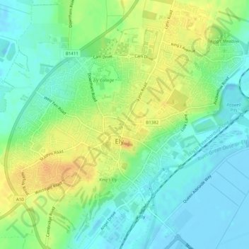
Name: Topografische Karte Ely, Höhe, Relief.
Ort: Ely, Cambridgeshire, East of England, England, United Kingdom (52.38615 0.24029 52.41585 0.28644)
Durchschnittliche Höhe: 13 m
Minimale Höhe: -4 m
Maximale Höhe: 29 m