Topografische Karte Cochrane
Interaktive Karte
Klicken Sie auf die Karte, um die Höhe anzuzeigen.
Über diese Karte
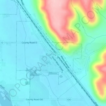
Name: Topografische Karte Cochrane, Höhe, Relief.
Ort: Cochrane, Buffalo County, Wisconsin, United States (44.21972 -91.84827 44.23593 -91.82498)
Durchschnittliche Höhe: 238 m
Minimale Höhe: 197 m
Maximale Höhe: 377 m
Andere topografische Karten
Klicken Sie auf eine Karte, um ihre Topografie, ihre Höhe und ihr Relief anzuzeigen.
Trevino
United States > Wisconsin > Buffalo County
Trevino, Town of Nelson, Buffalo County, Wisconsin, 55968, United States
Durchschnittliche Höhe: 206 m
Town of Gilmanton
United States > Wisconsin > Buffalo County
Town of Gilmanton, Buffalo County, Wisconsin, United States
Durchschnittliche Höhe: 285 m
Nelson
United States > Wisconsin > Buffalo County
Nelson, Buffalo County, Wisconsin, United States
Durchschnittliche Höhe: 234 m
Buffalo City
United States > Wisconsin > Buffalo County
Buffalo City, Buffalo County, Wisconsin, United States
Durchschnittliche Höhe: 209 m
Fountain City
United States > Wisconsin > Buffalo County
Fountain City, Buffalo County, Wisconsin, United States
Durchschnittliche Höhe: 224 m
Town of Mondovi
United States > Wisconsin > Buffalo County
Town of Mondovi, Buffalo County, Wisconsin, 54755, United States
Durchschnittliche Höhe: 281 m
Cream
United States > Wisconsin > Buffalo County
Cream, Town of Lincoln, Buffalo County, Wisconsin, United States
Durchschnittliche Höhe: 292 m
Mondovi
United States > Wisconsin > Buffalo County
Mondovi, Buffalo County, Wisconsin, United States
Durchschnittliche Höhe: 257 m
Alma
United States > Wisconsin > Buffalo County
Alma, Buffalo County, Wisconsin, United States
Durchschnittliche Höhe: 256 m
Buffalo River
United States > Wisconsin > Buffalo County
Buffalo River, Buffalo County, Wisconsin, United States
Durchschnittliche Höhe: 292 m