
Topografische Karte Williams County
Interaktive Karte
Klicken Sie auf die Karte, um die Höhe anzuzeigen.
Über diese Karte
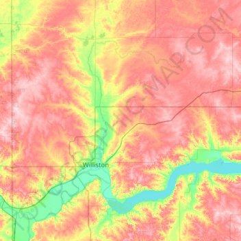
Name: Topografische Karte Williams County, Höhe, Relief.
Ort: Williams County, North Dakota, United States (47.95452 -104.04821 48.63486 -102.82892)
Durchschnittliche Höhe: 663 m
Minimale Höhe: 556 m
Maximale Höhe: 778 m
Andere topografische Karten
Klicken Sie auf eine Karte, um ihre Topografie, ihre Höhe und ihr Relief anzuzeigen.
Epping
United States > North Dakota > Williams County
Epping, Williams County, North Dakota, United States
Durchschnittliche Höhe: 676 m